Home | Main Menu | Castle Index | Historical Essays | Recommended Castles | What's New | Links
in the town of Cardigan, Ceredigion, west Wales
Photographs, drawings and text copyright © by John Northall
With acknowledgements to The Royal Commision on Ancient and Historic Monuments in Wales
CADW, and Mr Glen Johnson.
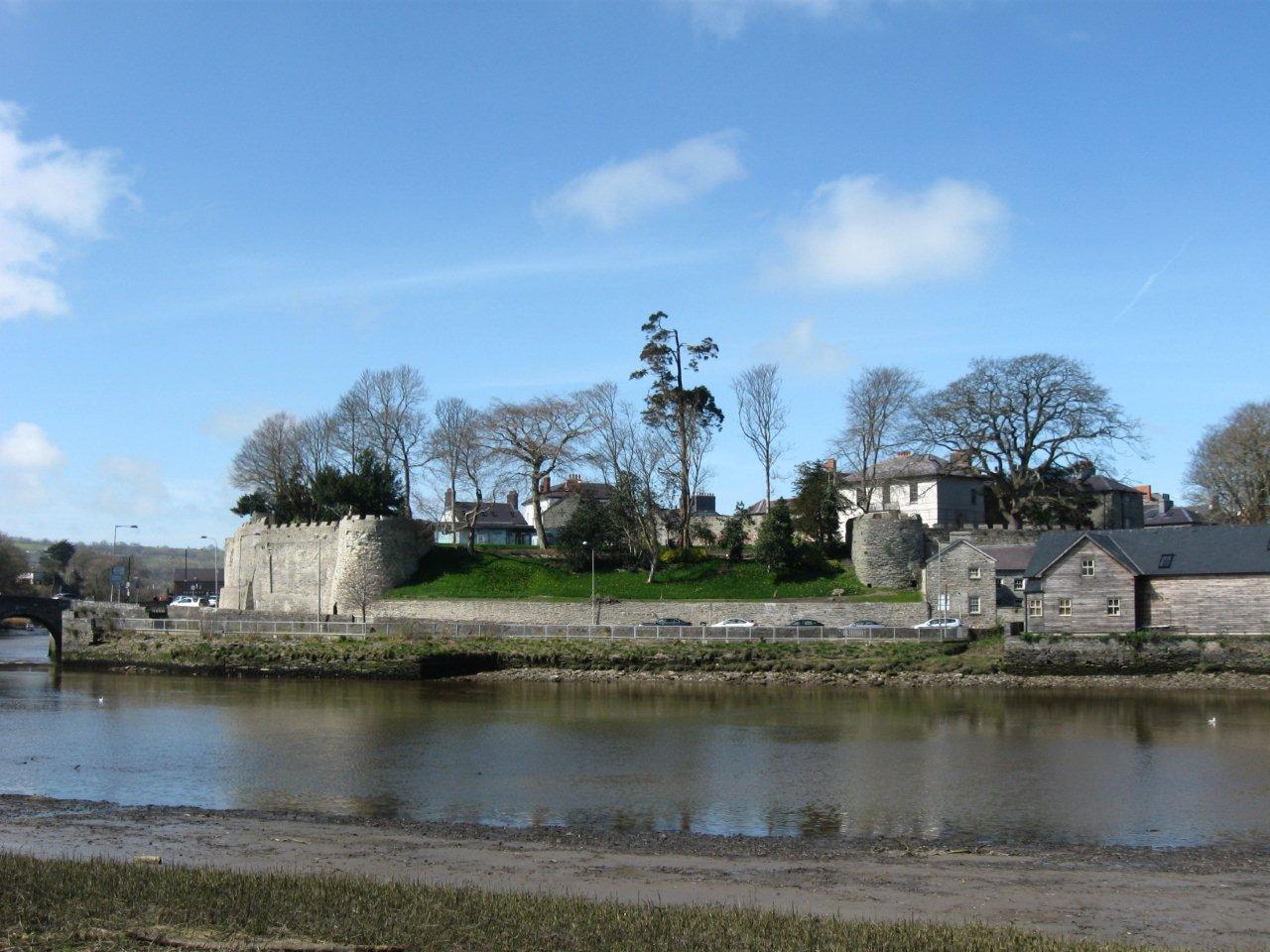
The east side of Cardigan castle seen across the river Teifi. The large white building is a large 19th century house that incorporates the keep.
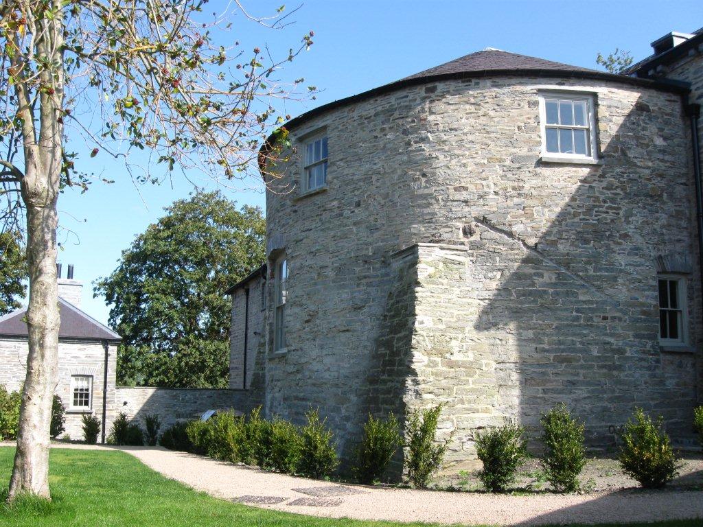
The medieval north tower or keep protrudes from the later house. It was originally at least one story higher and was built out into a wide ditch, the line of which is marked by the garden house at its northern edge and the east wing of the mansion. Cardigan castle stands on the northern bank of the River Teifi in the district of West Wales known as Ceredigion. Although this area of Wales is now relatively quiet it was once on the front line of the struggles between the Welsh and Normans.
The castle was built in several stages, starting with an earth and timber fortress founded by the norman invader Gilbert de Clare in 1110 AD, which superseded an earlier earthwork castle which had been built a mile downstream from Cardigan by Roger de Montgomery during his invasion of 1093.
The site of the old castle near Cardigan.
After Cardigan was captured in 1171 by the Welsh prince of south west Wales, Rhys ap Tewdwr (The Lord Rhys), the castle was rebuilt using stone in a comparatively rudimentary style. Nevertheless, it was good for its day and Rhys was proud enough of the results to hold the first national eisteddfod here in 1176.The men of the south won the singing competition and their oppenents from the north won the bardic poetry event, so honours were even. The truncated and partially buried east tower. The arrow loop opens from one of two flights of stairs that lead down to forward facing guardrobe chambers.
There were many armed struggles at Cardigan in the following years, more details of which can be seen on the Cardigan Castle timeline page, and around 70 years after Rhys' castle was built it was firmly back in the hands of the Normans. After Rhys had died in 1197 two of his sons, Maelgwyn and Gruffydd, fought over his lands. Maelgwyn seized the castle, surrendered his brother to the Normans and sold the castle to King John for a nominal sum. Cardigan was again rebuilt from 1244 to 1254 by Robert Waleran under the direction of the powerful Earl Gilbert of Pembroke and this time stone walls were added around the town that had grown up next to the castle. A reconstruction drawing of the castle as it may have appeared in the thirteenth century. The gatehouse and round tower are conjectural.
After many sieges and repairs over the following years and its subsequent decay the castle was refortified for use during the civil war in 1644. Following the parliamentary victory, the castle was slighted to prevent its further use as a fortress and the ruins were converted for peaceful purposes in the 18th and 19th centuries. Unfortunately for the castle lover, large parts of it were demolished to create a bowling green, mansion house and walled garden. |
Plan of the Norman castle at Cardigan. The town walls and presumed outer bailey to the north of the castle are not shown.
The final years of the twentieth century saw the castle walls choked with undergrowth and surrounded by crumbling houses. Enormous efforts have been made since then to clear the site, remove many old buildings from around the castle and preserve the masonry. The ruins that can be seen today principally date from the norman rebuild of 1244 overlain by a large 19th century house, although a second world war pillbox and a recent glass-fronted building are also prominent. The castle from the south west looking up towards the site of the main gate. A second world war pill box peeps over the battlements.
The castle was built on a ridge that jutted into the river Teifi and ended in a low cliff. It was cut off from the only easy approach along the ridge by a rock-cut ditch, which is similar to other castles associated with The Lord Rhys at Cilgerran, Nevern and Rhayadr (Rhaeadr Gwy near the mid-Wales border). The castle overlooked the lowest fording point of the river Teifi and protected a sheltered anchorage that was a few miles upstream from the Irish sea. Its elevated position afforded good views of the arterial valleys to the north, south, east and west. |
The rounded front of the great tower can be glimpsed between 19th century buldings which were built either side of the curving dry moat at the north of the site.
Looking across the enclosure towards the restored mansion. The enclosure walls at this point are not original.
The area outside the north-eastern end of the mansion house, towards the town, is situated on the crest of the ridge and excavations have revealed a cobbled surface. No town buildings seem to have been erected within it so it's likely to have been an outer bailey of the castle.
Looking north towards the town from the great tower. A garden occupies the site of the presumed outer bailey.
The main bailey sits at the southern end of the ridge between the in-filled castle ditch and the bridge over the Teifi, with roads running around three of its sides. The bridge and roads are relatively recent and the river originally lapped against the southern and eastern sides of the castle.
Tall revetment walls protect the southern side of the castle.
- Learn about the first castle at Cardigan (Cardigan Old Castle)
- Continue reading about the first stone castle at Cardigan that was built by the Welsh.
- Follow this link for a tour of the second stone castle at Cardigan.
- See the Cardigan Castle timeline.
- The norman town walls are described here.
- Rare pre-restoration photographs taken in 1991 within the castle!
- View Mr Northall's other contributions to the Castles of Wales web site
Home | Main Menu | Castle Index | Historical Essays | Recommended Castles |What's New |Links
Copyright © by John Northall and the Castles of Wales Website