Background Information:
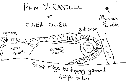
This primitive castle of unknown history shares some of the typical features of indiginous Welsh castles. It mixes the traditional dry-stone walled enclosure built on a naturally defensible site with a keep-like structure at its most vulnerable end (Oleumap.gif), and is similar to Carn Fadrun on the Lleyn Peninsular. Carn Fadrun was reported to have been newly built by Gerald of Wales (Giraldus Cambrensis) in 1188.
Pen-y-Castell is situated high on the eastern bank of the Conwy valley above the village of Maenan, about 7 miles upstream from the town of Conwy. It is close to a crossroads from where roads led to the ancient towns Llanwrst, Conwy, Denbigh and Bangor.
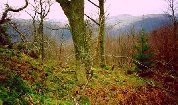
Right: Looking down towards the rock-cut ditch from the east side of the keep.
 The following information was taken from the RCAMW volume for Denbighshire: (My own notes are in brackets.) The following information was taken from the RCAMW volume for Denbighshire: (My own notes are in brackets.)
 Small fortress on a narrow ridge that has precipitous sides. There are 3 distinct areas formed by natural crags. Small fortress on a narrow ridge that has precipitous sides. There are 3 distinct areas formed by natural crags.
 On the north side there is a 5 ft deep rock cut-ditch (just visible below the rampart of the keep in Oleu2.jpg). On the north side there is a 5 ft deep rock cut-ditch (just visible below the rampart of the keep in Oleu2.jpg).
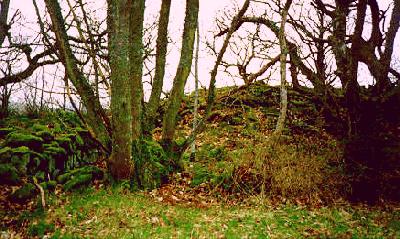
 D-shaped enclosure of strong dry-stone wall still 3 ft high in places (the interior of the D-shaped keep can be seen in Oleu3.jpg). D-shaped enclosure of strong dry-stone wall still 3 ft high in places (the interior of the D-shaped keep can be seen in Oleu3.jpg).
 There is no visible entrance into the keep. (This suggests an elevated entrance such as is found at Ewloe.) There is no visible entrance into the keep. (This suggests an elevated entrance such as is found at Ewloe.)
Right: Looking west within the keep.
  A small ditch within the keep may be the footings of a round wooden tower. (Surely it would be impractical to make a wooden tower round? The "ditch" reminded me of the dripmarks that can be seen in iron/dark age hill-forts formed by the run-off from large conical thatched roofs.) A small ditch within the keep may be the footings of a round wooden tower. (Surely it would be impractical to make a wooden tower round? The "ditch" reminded me of the dripmarks that can be seen in iron/dark age hill-forts formed by the run-off from large conical thatched roofs.)
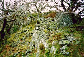
 The southern end of the ridge has walling in areas that are less precipitous. (i.e. where the limestone cliffs give way to steep slopes.) These are poor except in the north-west (Oleu4.jpg.) The southern end of the ridge has walling in areas that are less precipitous. (i.e. where the limestone cliffs give way to steep slopes.) These are poor except in the north-west (Oleu4.jpg.)
 The entrance is at the southern apex of the ridge and was protected by additional walling at its lower end. (In typical Welsh fashion, the approach to the entrance runs immediately below the wall adjacent to the gateway to deter attacks.) The entrance is at the southern apex of the ridge and was protected by additional walling at its lower end. (In typical Welsh fashion, the approach to the entrance runs immediately below the wall adjacent to the gateway to deter attacks.)
Additional Information:
There are 2 carefully constructed pits or "guard points" situated within the keep wall either side of its northern end. They are not mentioned in the RCAMW volume but seem to be comtempory to the use of the site as a fortified place. They have vertical inner walls of faced stone and are very well placed to ward off attacks on the most vulnerable side of the castle, overlooking the rock-cut ditch. I have marked them on the site plan (Oleumap.gif).
Below: My own freehand sketch based on the site plan given in the RCAMW volume.
|


 The following information was taken from the RCAMW volume for Denbighshire: (My own notes are in brackets.)
  Small fortress on a narrow ridge that has precipitous sides. There are 3 distinct areas formed by natural crags.
