|
Rudbaxton Rath Castle:
After the Norman conquest of England in 1066 the Normans infiltrated westward into Wales and seized the southern part of Pembrokeshire. The Anglo-Norman Barony of Dungleddy (Daugleddau in Welsh) was created in the 11th century and was protected with rapidly built earthwork castles.
One of these was situated within the sub-circular Iron Age hillfort of Rudbaxton Rath, which was refortified and given a polygonal inner enclosure of earth and timber against the south western arc of the massive iron age bank. It seems to have been known as Symon’s Castle.
The entrance to the medieval enclosure was at its northern end but the location of the gateway into the refortified outer bank is unclear. The large gap in the northern end of the bank is currently used for farming and may be modern. There's another gap at the southern end of the iron age enclosure that appears to have been a better protected entry point.
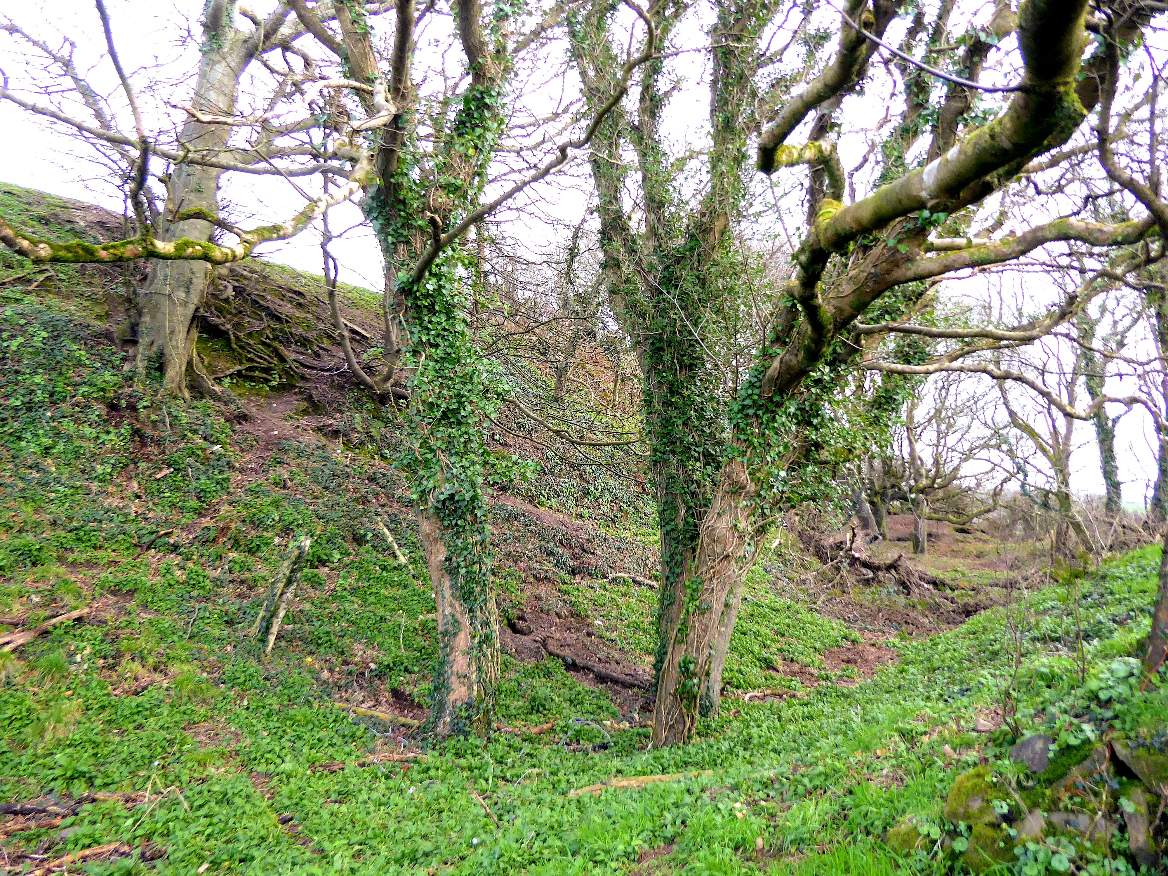
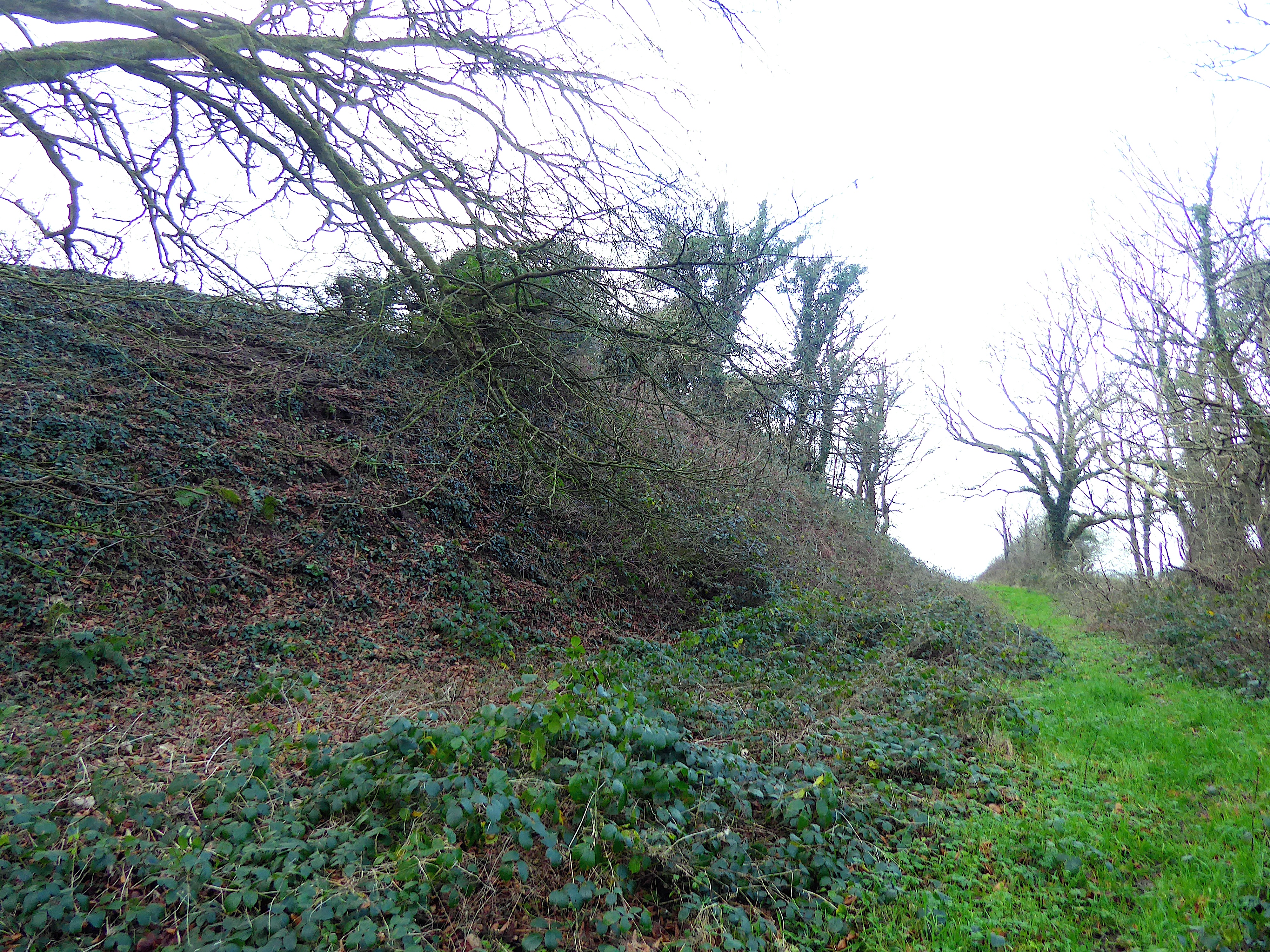
The medieval enclosure within the outer bank has been levelled through farming and can best be discerned from aerial photos. The iron age bank around it still stands up to 15 feet high in places and is surrounded by a ditch and smaller counterscarp bank towards the east, south and west sides of the castle.
Ownership of Symon's Castle was passed to the Knights Hospitallers of St John in 1148 by Alexander Rudepac, the Lord of Rudbaxton. A chapel dedicated to St Leonard was built outside castle and an access path to it passes over the eastern outer rampart. The chapel had a holy well which can still be found towards the east of the modern entrance to the rath. St Leonard's Chapel was known to be used for at least 200 years but the site appears to have been abandoned by the 1500s.
Rudbaxton Rath is situated about 1.5 miles north of Crundale and can be seen from the road towards the village of Clarbeston Road (Chapel Road). A public footpath north of a field hedge opposite a small lane leads eastwards to the castle. As of 2025 the footpath sign has been broken off but its post is still standing next to a field gate.
Credit: Jenny Hall & Paul Sambrook: https://coflein.gov.uk/media/254/82/657067.pdf
Additional Photographs of Rudbaxton Rath Castle
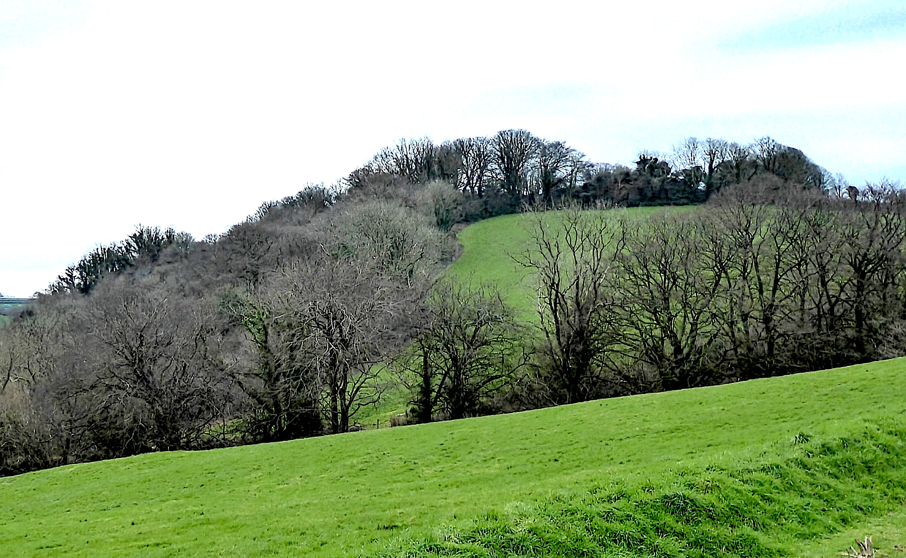
Rudbaxton Rath is situated on a hill overlooking the steep-sided valley of Carlett Brook.
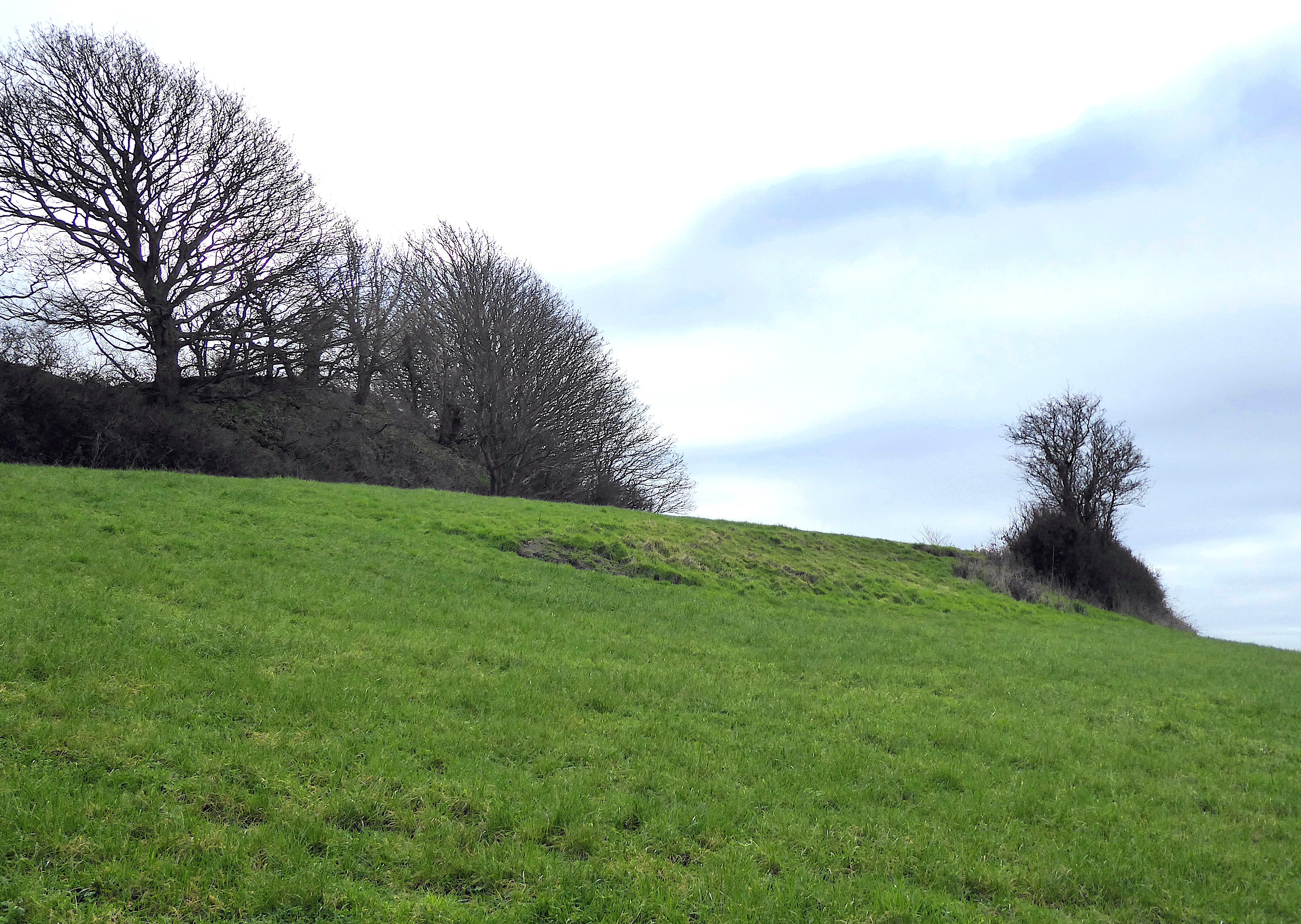
The iron age fort had two protective banks, the outer bank to the west having been damaged by ploughing.
The medieval castle was an elliptical enclosure inside the upper bank.
The inner and outer banks of the main enclosure above the valley on the eastern side.
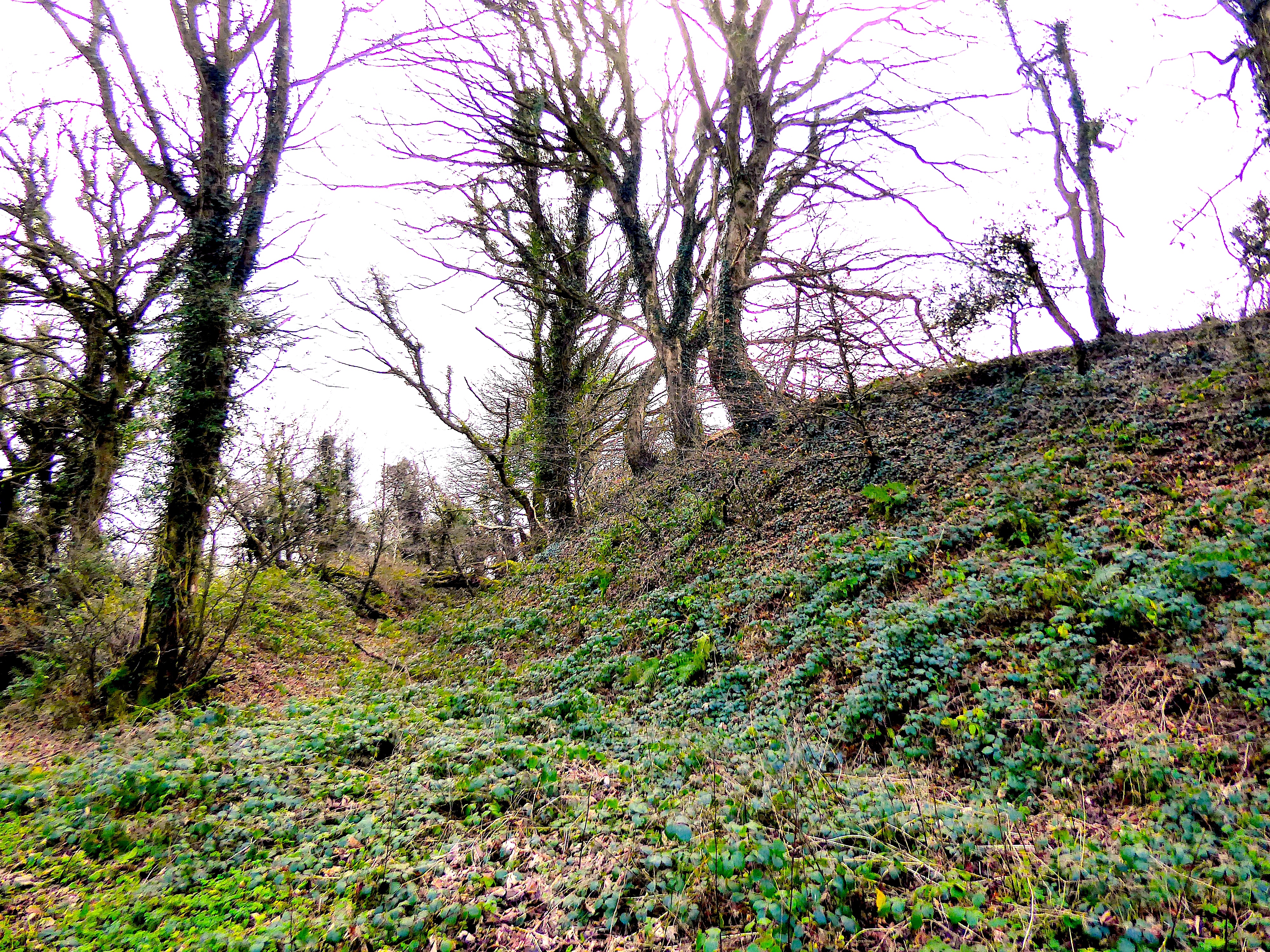
The northern end of the main enclosure. The modern entrance through the bank is just around the corner.
 View Mr Northall's other contributions to the Castles of Wales web site View Mr Northall's other contributions to the Castles of Wales web site
|